Whether you’re road-tripping through the Rockies or planning a weekend getaway, the Municipality of Crowsnest Pass is easy to reach and rewarding to explore.
Where We Are
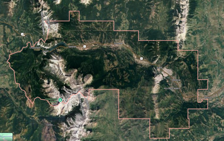
Crowsnest Pass is located in southwest Alberta, along Highway 3 (Crowsnest Highway), near the BC border. We're about:
-
2.5 hours southwest of Calgary
-
1.5 hours west of Lethbridge
-
1 hour east of Fernie, BC
The Crowsnest Pass includes five historic communities—Bellevue, Hillcrest, Frank, Blairmore, and Coleman—each with its own charm and all within a 15-minute drive of one another.
Getting Here by Road
The most common way to reach the Pass is by vehicle via Highway 3. This scenic route winds through foothills, forests, and open valleys—offering beautiful views no matter the season.
From Calgary:
Scenic Route: Take Highway 2 south to Nanton, then Highway 533 west to Highway 22 (The Cowboy Trail). Continue south to Highway 3 and head west.
Highway Route: Take Highway 2 south to Fort Macleod, then west on Highway 3.
From Lethbridge:
Follow Highway 3 west directly into Crowsnest Pass.
From BC (Fernie or Cranbrook):
Follow Highway 3 east over the Crowsnest Pass summit into Alberta.
Transit & Shuttles
At this time, there is no public transit into or within Crowsnest Pass. Some private taxi services operate, check with local lodges or event organizers for options.
Getting Around Locally
Once you’re here, most amenities, parks, and trailheads are a short drive apart. Parking is free in most areas, and many visitors also enjoy biking the Crowsnest Community Trail, which connects Blairmore, Coleman, and other key sites.